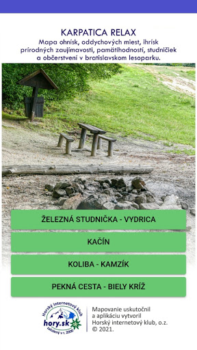
Features KARPATICA RELAX
Map of fireplaces, recreation places, playgrounds, natural attractions, sights, wells and refreshments in the Bratislava Forest Park.The application is an interactive map of relaxation places in the Bratislava Forest Park.
The application does not serve as navigation.
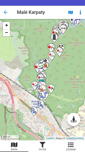
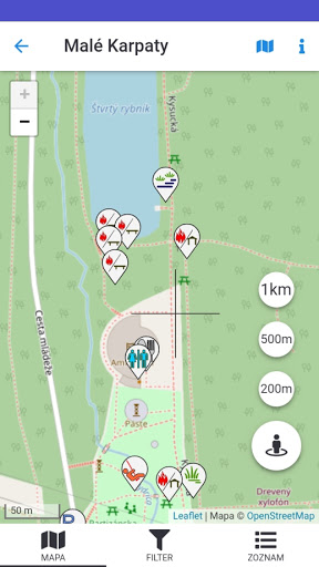
The application determines your location in the field and allows you to view the nearest locations for rest.
The scale of the map can be changed.
Sites can be viewed directly from the map or from a list.
A filter helps you to easily select locations from a list or from a map.The map was created on the basis of field mapping of fireplaces, rest areas, childrens playgrounds and sports grounds, natural attractions, sights, wells and refreshments in the vicinity of the most frequently visited localities and routes of the Bratislava Forest Park.The map contains more than 440 locations with descriptions and photos.The map is divided into 4 areas:1.
Červený most - Vydrica (valley of the Vydrica stream from the Military Hospital, across Červený most, Železná studnička, Snežienka to the U Slivu buffet),2.
Kačín - Malý Slavín (from Lamač and Železná studnička through Kačín and Malinský vrch to Malý Slavín),3.
Koliba - Kamzík (from the final trolleybus at Koliba and Kramárov through Kamzík to the Tri duby saddle),4.
Rača - Biely kríž - Pekná cesta - Krasňany (from Rača and Krasnian to the ridge path of the Little Carpathians in the section of the Tri duby saddle to the White Cross).The mapping was performed and the application was designed by the team of the Mountain Internet Club, o.z., High Tatras.
The mapping took place between 2019 and 2021.We wish you a pleasant stay in the Bratislava forests of the Little Carpathians.
Gaming Features
Enjoy immersive gaming experience with various game modes.
Camera Features
Advanced camera features with editing capabilities.
Food & Dining
Discover recipes and order food from your favorite restaurants.
See the KARPATICA RELAX in Action
Get the App Today
Available for Android 8.0 and above